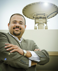
 Dr Haris KONTOES (NOA) acts as the overall Project Coordinator responsible for ensuring that the project runs efficiently, the resources are properly allocated, and that deliverables are developed and delivered according to the work plan and quality standards. He ensures the effective cooperation between the partners and the PCT, WMB, GA, and AB boards. Haris Kontoes has a longstanding experience in coordinating a large number of EU, ESA, and transnational projects, in the context of EU flagship EO programs. He has been managing the development and sustained operation of Copernicus infrastructures in the SE Europe and Balkans regions (e.g. the Hellenic Sentinel Data Hub), and has been assigned leading roles in the organisation of international research forums, including GEO and Copernicus relevant congresses. He has been assuming the leading role in the coordination of national delegations in the context of International Organisation Boards and Space Committees (e.g. ESA PBEO, EC Space Committees, GMES Steering Committee, Space Advisory Committee, etc.).
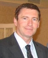
 Mr Lefteris MAMAIS (NOA) is the Technical and Quality Assurance Manager and provides support to ensure the smooth running of the project, maintaining the schedule of the deliverables and progress / financial reporting. He has been the project manager of international projects including GNSS.asia (FP7) and framework contracts with DG ENTR (e.g. EMS User Guide, European Space Expo). Lefteris has a solid knowledge of programmatic, strategic and business aspects of the EU Space Programmes: he has previously worked at the DG ENTR unit responsible for Galileo Project Management and has been involved in several Copernicus-related projects, contributing to Exploitation and Dissemination WPs.
 Ms Alexandra JERCAIANU (EURISY) is the Dissemination Manager to ensure the coordination of the different dissemination activities in a timely and efficient way. Alexandra has a large experience in organising events, mobilising stakeholders across public administrations and agencies, industry, SMEs from both space and non-space sectors, and has acted as moderator of roundtables and dissemination workshops, connecting end-users and space community actors.
 Ms Eleni CHRISTIA (NOA) is the Exploitation Manager, supporting EARSC (as T7.2 leader) in the exploitation of the project’s outcomes and promoting the sustainability of the project’s components both within planned activities and in cooperation with external parties. Eleni has assumed the role of project manager in GEO Secretariat towards Building the Capacity Strategy of GEOSS in the developing Countries. In the past she acted as the exploitation and dissemination manager of the Capacity Building project BEYOND in SE Europe and Balkans regions.
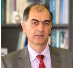
 Dr Evangelos GERASOPOULOS (NOA): He acts as the Liaison Officer to coordinate related activities, facilitate communications to identified target groups and provide regular updates to the WP Management Board. He is member of the 6th and final Evaluation Team of GEOSS (also in the 5th) and Director of the Greek GEO Office, national delegate in the last GEO Plenary, and as such he has developed strong collaboration bonds with GEO Secretariat and key EC officers.
 Professor George Zalidis (i-BEC) is the Director of the Laboratory of Remote Sensing and Geographical Information Systems, and the Laboratory of Remote Sensing and G.I.S., at the Faculty of Agriculture, at the Aristotle University Of Thessaloniki, he is also the Scientific Coordinator of i-BEC, the only GEO Participating Organization in the Balkans. His specialization in the field of Applied Soil Science started with a Degree of Agriculture (Faculty of Agriculture, A.U.Th., Greece) and continued with a PhD in Soil Physics from the Michigan State University in U.S.A. He is also a member of numerous national and international professional organizations, and has been an Affiliate Professor in International Institutes. He has worked and supervised in over 60 national and European research projects for environmental sustainability, bio remediation of degraded areas, restoration and rehabilitation. His research is focused on topics such as soil pollution, soil degradation, wetland ecosystems, wetland inventory and mapping.
 Prof. Hesham El-Askary (CEDARE) is a Professor of Remote Sensing and Earth Systems Science and the director of the Graduate Programs in Computational and Data Sciences in the Schmid College of Science and Technology, Chapman University. He is also an Associate Professor of Environmental Physics on leave with the Department of Environmental Sciences, Faculty of Science, Alexandria University, Egypt. Dr. El-Askary serves on the Ministry of Justice consultant team for Environmental affairs. The work of Dr. El-Askary focuses on earth observation related research with the aim of providing timely and accurate information, forecasts and projections. In his role, Dr. El-Askary oversees the project for North Africa and the Middle East working with 23 institutions in Europe, North Africa and the Gulf nations, and with more than 200 individuals.
GEO-CRADLE is assisted and guided by a number of known experts who compose the project’s Advisory Board (AB), the invitation of whom took full account of the specific objectives that GEO-CRADLE seeks to achieve. The members of the AB:
- support the alignment of GEO-CRADLE activities to the strategic priorities of key organisations (ESA, EC-Copernicus, GEO Secretariat);
- provide expert advice for the specific thematic areas addressed by the project through the 4 pilots;
- ensure efficient coordination with other important actions that promote the implementation of GEOSS and Copernicus in the region of interest (e.g. ConnectinGEO, AfriGEOSS);
- support the project in networking and access to datasets and monitoring networks.
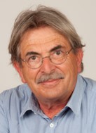
 Prof. Kanaris Tsinganos is the Director of NOA and President of the Governing Board. He has served as member of the National Advisory Council for Research and Technology, National Delegate to the ESA Science Programme Committee and Deputy National Delegate to GEO. He is hosting and chairing the Advisory Board meetings on behalf of the coordinator (NOA).
 Dr. Peter Zeil is currently working as a senior expert for Spatial Services Gmbh. Previously he was a seconded national expert (from Z-GIS) at the European Commission – DG GROW Unit K2, responsible for the Copernicus Emergency Management Service. He is a well-known expert in the field of EO services and applications. He has been instrumental in several capacity building projects in Africa, including BRAGMA and in several GEO-related actions (e.g. EnerGEO). He brings an excellent network of EO stakeholders in Europe, Africa and Middle East.
 Dr. Luca Montanarella is a scientific Officer in the EC Joint Research Centre (JRC) and Chair of the Intergovernmental Technical Panel on Soils (ITPS). In his career he has served as Principal Administrator at the Italian Ministry of Agriculture, Head of the JRC action “Soil Data and Information Systems”, Head of the European Soil Bureau project. He brings his valuable expertise in soil databases, GIS, soil protection and land degradation.
 Dr. Ivan Petiteville joined ESA as system engineer and then project manager of several satellite EO ground segments and Head of the Multi-mission Ground Segment Office. He has been involved in the Committee for Earth Observation Satellites (CEOS) since 2000. He was Chair of the CEOS Working Group in Information Systems and Services, and then CEOS Executive Officer, insuring a proper interface between CEOS and GEO. Since 2011, he has been leading the coordinated efforts of the major space agencies in the world, in the field of Disaster Risk Management, as Chair of the CEOS Working Group on Disasters. In addition, he was one of the Co-Chairs of GEO Architecture and Data Committee, representing CEOS, and currently member of the GEO Programme Board as alternate representative for CEOS.
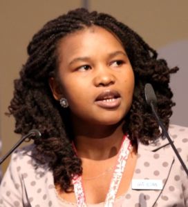 Ms Andiswa Mlisa is Scientific and Technical Officer in the Group on Earth Observations (GEO) Secretariat. She has over 13 years experience developing Earth Observations and geospatial techniques for hydrogeology and earth science applications. In her current role at the GEO Secretariat she is facilitating the implementation of AfriGEOSS, a trans-continent initiative to coordinate and reinforce synergies among national and/or regional EO efforts in Africa and globally. She is also responsible for the coordination of capacity building initiatives in GEO, which aim to build infrastructure, institutional and individuals’ capacity to foster use of EO for informed decision-making.
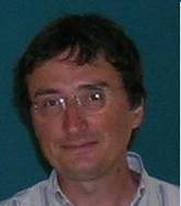
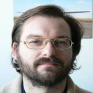 Dr. Joan Masó Pau is a Researcher in CREAF (Centre de Recerca Ecològica i Aplicacions Forestals) and coordinator of the ConnectinGEO project. He is President of the Earth and Space Science Informatics (ESSI) division of the European Geosciences Union (EGU), member of the GEOSS Standards and Interoperability Forum, the Open Geospatial Consortium (OGC), and the GML2JP2 standards working group. He brings in his expertise in digital cartography, web technologies, Geo-services, and GEOSS standards.
 Dr. Nikolaos Arvanitidis is Economic Geologist with more than 35 years as Researcher at the Geological Institute of Stockholm University, R&D Project Manager on mineral exploration and development projects and Regional Division Director at the Institute of Geology and Mineral Exploration in Greece, Senior Specialist at the Geological Survey of Finland and presently Head of Economic Geology Division at the Geological Survey of Sweden. He is Chair of the Mineral Resources Expert Group at EuroGeoSurveys, Executive Secretary of the European Technology Platform for Sustainable Mineral Resources and operational member of the European Innovation Partnership on Raw Materials Strategic Implementation Plan. He is also active member of the Raw Materials Supply Group, the working groups on Criticality and ERECON, and the Advisory Group on Challenge 5 under Horizon2020.
 Dr. Elena Xoplaki is Associate Professor in the Section of Climatology of the Justus-Liebig University, Giessen, Germany. She is a core partner of EU-FP7 CLIM‐RUN (Climate Local Information in the Mediterranean region: Responding to User Needs), ACQWA (Assessing Climate impacts on the Quantity and quality of WAter), Co-PI of the EU-FP6 CIRCE (Climate Change and Impact ResearCh: the Mediterranean Environment). Her valuable contribution is expected in climate change adaptation in the RoI and access to regional databases on climate and water resources.
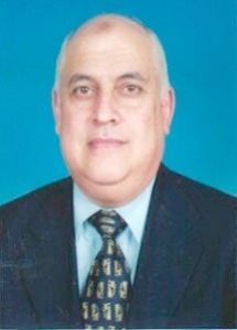 Prof. Ayman El Dessouki Ibrahim is Emeritus Professor of Computers at the Electronics Research Institute, Ministry of Scientific Research, Egypt. He was Chairman of the National Authority for Remote Sensing and Space Sciences (NARSS) from 2006 to 2011. From 1983 up to now he also works on the Development of Software Systems for Industrial Firms; the Design & Implementation of Software Systems for Decision Support & Information Centers and Networks; and Feasibility Studies & Assessment of Needs & System Analysis and Design & Procurement Procedures.