1. Adaptation to Climate Change (ACC)
SERVICES:
- If you looking for open access to future Climate Change Data for Europe click here Climate Change Data – Models
- If you are looking for Climate Change Dust Data click here Climate Change Data – Dust Data
ABOUT:
The RoI has been recognised by the Intergovernmental Panel on Climate Change as one of the most sensitive and vulnerable to climate change regions on Earth. Climate change is governed to a large extent by atmospheric processes, in particular, the interaction between radiation and atmospheric components (e.g. aerosols, clouds, greenhouse, and trace gases), some of which also contributing significantly to air quality degradation. The Adaptation to Climate Change pilot supported the sustainability of regional EO infrastructures. It focused on the holistic monitoring and forecasting of region-specific atmospheric components, ECVs and hazards, in line with the standards and vision of GEOSS & Copernicus. It provided services related to desert dust, climate change, and air quality, benefiting key end users, and engaging aviation authorities, environmental and civil protection institutions and state agencies, as well as public/private sectors e.g. tourism, agriculture, natural hazards and water management.
LEADER: National Observatory of Athens (NOA)
2. Improved Food Security – Water Extremes Management (IFS-WEM)
SERVICES:
- If you looking for a dataset containing a regional vis-NIR (350-2500 nm) soil spectral library of the region BAMENA click here Spectral Soil Library
ABOUT:
Food security depends on many aspects such as water abundance and extremes (flooding and drought), vegetation stresses, yield monitoring, soil quality monitoring and sustainability. Plants need nitrogen, phosphorus and potassium, none so easily available in the RoI. Common standards and protocols following the FAO principles for long-term monitoring of soils and minerals defined for the first time in the RoI. Also for the first time the available EO means, service chains, and methods developed in soil science discipline over the past years evaluated,tailored and met the RoI specific mapping needs. A scientific challenge of using multiple satellite missions including the Copernicus missions, together with a large dataset of field spectral measurements addressed.
The Improved Food Security – Water Extremes Management pilot transferred state-of-the-art know-how between the involved countries on soil spectroscopy, and built for the first time a standardized regional Soil Spectral Library, as a complement to the EU Soil Sample Data Base, serving the food security and agriculture sectors. It provided detailed thematic soil maps by analysing the soil spectra with Sentinel-2 image acquisitions. Moreover, in support to the agriculture production and flood/drought mitigation, the pilot adapted and launched a region specific version of the myDEWETRA web platform. The delivered services have strong potential to support EU agricultural policy and initiatives (e.g. SDGs, PRIMA).
LEADER: InterBalkan Environment Center (i-BEC)
3. Access to Raw Materials (ARM)
SERVICES:
- If you looking for EGS data for Greece, Cyprus & Turkey click here EGS Data
ABOUT:
The Access to Raw Materials pilot studied mining and post-mining sites, focusing on EO based solutions to support the sites’ management and mitigation of their environmental impact on the surrounding areas. All the methodologies were elaborated on the basis of Copernicus data integration and were delivered having a universal character, applicable for other RoIs as well. The pilot engaged key private and public/state organisations from the mining and environmental sectors.
LEADER: EuroGeoSurveys – The Geological Surveys of Europe (EGS)
4. Access to Energy (SENSE)
SERVICES:
- If you looking for open access data on the solar energy for Egypt and Greece click here Egypt Solar Energy
ABOUT:
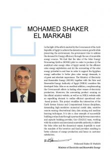
The Access to Solar Energy (SENSE) pilot took advantage of the free access to Copernicus data and Core services, innovative modelling and state-of-the-art real-time solar energy calculating systems, and delivered reliable and high resolution solar Atlases and broader climatology studies. It engraved strategic methods to integrate a solar energy nowcasting system into a wider GEOSS driven system at global scale. It stimulated the interest of key energy stakeholders and decision makers from the private and public/state sector in various countries, e.g. Egypt where it was acknowledged by the Ministry of Electricity and Renewable Energy and is currently integrated in its official website, serving the needs of potential solar investors.
Presentation: Access to Energy (SENSE), The SOLAR ATLAS of Egypt.
LEADER: Physikalisch-Meteorologisches Observatorium Davos/World Radiation Center (PMOD/WRC)
Testimonials:


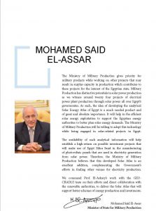
Minister of State for Military Production, Egypt
The objective of the pilot activities is not to develop new science but to build on the integration of available capacities (infrastructure, datasets, models, etc.) and skills, towards the provision of improved EO Services in the RoI. The pilots will span a period of 15 months (M09-M24), and the final results will be presented to relevant stakeholders (especially decision makers) in a dedicated workshop.
